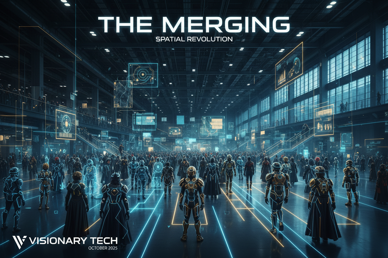
💡 Systemic Briefing: For decades, the convention industry treated physical venues as static, passive containers. Event management relied on printed vinyl signage, physical booths, and 2D PDF floor plans—systems that fundamentally failed when tens of thousands of attendees gridlocked indoor spaces. In 2026, the proliferation of consumer spatial hardware (advanced AR smart glasses and high-throughput smartphones) has triggered an infrastructure-level paradigm shift. Large-scale conventions are discarding legacy wayfinding entirely. By integrating Visual Positioning Systems (VPS), Geomagnetic Sensor Fusion, and Persistent Spatial Anchors, the 2026 convention has transformed from a mere physical gathering into a live, multi-layered Hybrid Spatial Computing System. Physical venue architecture is now just the hardware; interactive augmented reality has become the operating system.
1. The Infrastructure Crisis of the Legacy Venue
To understand the shift toward spatial computing, one must first analyze why traditional indoor event layouts fail under mass subcultural gatherings.
Conventions present an extreme operational environment: thousands of high-density booths constantly shift locations, global satellite positioning (GPS) degraded by concrete roof trusses renders standard maps useless, and massive foot-traffic choke points form unpredictably.
[ Legacy Event Model: Broken Information Flow ]
Static Floor Plan (PDF/Print) ──> High Cognitive Load ──> Attendee Disorientation ──> Choke Point Bottlenecks
                                                                                               │
                                                                                               ▼
Staff Overwhelm ─────────────────> Real-Time Layout Changes Lost ──────────────────────> Operational Failure

[ 2026 Spatial Computing Model: Continuous Synchronization ]
Physical Venue Mesh (LiDAR/VPS) ──> Real-Time Location API ──> Spatially Anchored HUD ──> Dynamic Route Optimization
                                                                                               │
                                                                                               ▼
Crowd Distribution Analytics <─── Fluid Crowd Re-routing <─── Context-Aware Interaction <───────┘
When a venue relies on physical infrastructure, it cannot adapt. A last-minute stage delay or an unannounced artist autograph session creates immediate localized congestion. Because the information layer is unlinked from the physical layout, organizers cannot redirect crowd flow in real-time. The hybrid spatial computing system solves this by treating the entire convention center as a living digital twin, where layout data, user locations, and structural geometry are continuously synchronized.
2. The Technical Stack of the 2026 Spatial Engine
Transitioning a standard convention hall into an interactive computing grid requires a highly resilient, cross-platform technical stack. The 2026 systems move away from power-heavy Bluetooth Beacons (BLE) to leverage device-native computer vision.
🌐 Visual Positioning Systems (VPS) & SLAM
Instead of relying on hardware broadcasting nodes fixed to walls, modern venue digitalization utilizes Visual SLAM (Simultaneous Localization and Mapping). Before the event opens, the venue’s interior is pre-scanned via LiDAR and high-resolution photography to generate a dense, coordinate-accurate 3D Spatial Mesh. When an attendee lifts their AR glasses or mobile device, the native camera matches its current frame against the visual features of the pre-rendered cloud map. This delivers sub-meter positioning accuracy indoors, entirely eliminating the "blue dot drift" common to legacy Wi-Fi and radio-based tracking systems.
🌐 Persistent Spatial Anchors & Occlusion Engine
For a digital space to feel authentic, virtual assets must adhere to the physical laws of the venue. Spatial computing engines deploy persistent anchoring protocols ensuring that a digital waypoint, a virtual message board, or an interactive localized event remains locked to the exact physical pillar, booth, or balcony layout across thousands of concurrent user sessions. Furthermore, advanced depth-sensing algorithms enable real-time graphic occlusion: if a physical attendee or a solid structural wall moves between the user and the spatial anchor, the digital asset is correctly masked, seamlessly embedding the software layer into the material environment.
📋 3. Case Studies: How Character Silhouettes and Textiles Interface with Spatial Systems
In a hybrid spatial computing system, character costumes are no longer just passive artistic expressions; they act as the primary physical inputs that the AR environment interacts with. Below is a deep structural breakdown of how four iconic character architectures and their specific fabric configurations serve as functional nodes within a digitalized venue.
┌────────────────────────────────────────────────────────────────────────┐
│  [AR HUD NAVIGATION OVERLAY - CONVENTION HALL DETACHED SLEEVE HUD]    │
│                                                                        │
│   ▲  [NAV LINK: HIGH-REFLECTIVE VECTOR] ──────────────────────┐        │
│   │  System: SLAM Mesh Locked / Occlusion Enabled              │        │
│                                                                        │
│   ├─── [TACTICAL OVERLAY INTERFACE] ──────────────────────┐   │        │
│   │    Target: Creator Zone A-24 / Cyber-Sleek Sector     │   │        │
│   │    Status: Heavy Congestion ──> Rerouting...          │   │        │
│   │                                                       │   │        │
│   │             [COSER WALKING IN DETACHED SLEEVES]       │   │        │
│   │             ┌────────────────────────────┐            │   │        │
│   │             │  [HIGH-CONTRAST SILHOUETTE]│            │   │        │
│   └────────────►│  Laser-Etched Neoprene     │◄───────────┘   │        │
│                 │  Reflective Mesh Tracked   │                │        │
│                 └────────────────────────────┘                │
└────────────────────────────────────────────────────────────────────────┘
1. Hatsune Miku — Cyber-Sleek Geometry as High-Contrast Waypoints
🧬 The Costume Architecture & Fabric Analysis
Hatsune Miku’s structural silhouette is defined by its sharp, retrofuturistic school-uniform framework. The defining elements are her exaggerated, flared detached sleeves and longline panels, contrasted against a matte charcoal body. In high-end fabrication, these sleeves are engineered using structured 3-layer Gore-Tex and laser-etched reflective neoprene, allowing them to hold a rigid, geometric flare that detaches entirely from the natural contours of the human arm.
🔧 The Spatial System Integration
Within a digitalized venue, Miku’s costume acts as a perfect high-contrast physical waypoint. The AR navigation system leverages the sharp, geometric separation of the detached sleeves to track movement vectors across crowded corridors.
When user smart glasses scan a crowded room, the VPS engine isolates the reflective neoprene tracks on the sleeves, using them as mobile physical anchors. The system can overlay glowing, neon-turquoise directional arrows that trace parallel to the sleeve's contours. As a result, a Coser walking through a congested techwear sector becomes a literal, moving navigation node, projecting real-time routing data onto the physical space around them.
2. Makima — Subversive Corporate Tailoring and Razor-Sharp Occlusion Boundaries
🧬 The Costume Architecture & Fabric Analysis
Makima’s visual profile rejects subcultural excess in favor of severe, corporate minimalism. Her silhouette relies on a crisp, high-waisted tailored trouser configuration, a slim black tie, and a sharp white dress shirt. To achieve the absolute flatness required for this look, fabricators deploy heavy-weight wool gabardine and internal horsehair canvas lining inside the shirt plackets and trouser waistbands, eliminating any soft draping or wrinkles.
🔧 The Spatial System Integration
In a hybrid computing matrix, Makima’s razor-sharp tailoring serves as an ideal baseline for testing real-time graphic occlusion boundaries. Because her silhouette consists of high-contrast, perfectly flat monochrome surfaces (pure white shirt against deep black tie and trousers), the venue's depth-sensing cameras can map her physical boundaries with millimeter precision.
When an AR UI element—such as a floating booth description banner—needs to pass behind her, the system uses the sharp lines of her wool gabardine shoulders and internal canvas collar to mask out the digital assets instantly. Her garment operates as a physical clipping mask, ensuring that floating digital data pops behind her corporate frame cleanly without any glitching or edge bleed, elevating the spatial realism of the entire venue.
3. Frieren — Pastoral Cottagecore and Organic Flowing Pathing Filters
🧬 The Costume Architecture & Fabric Analysis
Frieren’s aesthetic brings an organic, slow-fashion vocabulary to the convention floor, drawing heavily from historical Northern European pastoral silhouettes. The garment centers on a high-collared tunic dress and a sweeping, drop-shoulder winter long coat. It is crafted using unbleached linen-cotton blends, heavy felted merino wool, and brushed cashmere, which give the coat a heavy, fluid, and non-reflective drape that moves gracefully with human motion.
🔧 The Spatial System Integration
The spatial engine treats Frieren’s heavy, flowing merino wool coat as a canvas for organic, low-contrast pathing filters. Because her fabrics are completely matte and non-reflective, they absorb harsh venue lighting rather than bouncing it back into AR cameras.
The spatial navigation system uses this soft texture profile to anchor relaxed, slow-paced exploration paths. When an attendee wearing AR glasses looks at a Coser in Frieren's attire, the routing engine projects winding, pastoral geometric trails onto the floor that mimic the fluid, drop-shoulder lines of her coat. The software intentionally dampens its aggressive neon UIs, using her organic linen and cashmere textures to anchor soft, gold-rimmed data boxes, transforming a sterile concrete hall into an elegant, low-stimulus environment.
4. Rumi — Asymmetric Hyper-Pop Tactical Wear and Dynamic Grid Clustering
🧬 The Costume Architecture & Fabric Analysis
Rumi represents the cutting edge of tech-infused virtual idol design, anchoring a style known as Hyper-Pop Tactical Wear. Her costume breaks all traditional symmetries, featuring asymmetric crop architectures, multi-pocket utility strapping, and heavy industrial combat boot integrations. The textiles are built for performance and high visual noise: reinforced ripstop nylon, bright neon-dyed industrial webbing straps, and clear PVC transparency overlays.
🔧 The Spatial System Integration
Rumi’s asymmetric, high-velocity design is weaponized by the spatial computing engine to handle dynamic crowd grid clustering. Her multi-pocket ripstop nylon straps and decorative D-ring clusters provide a dense array of physical tracking coordinates.
When a large crowd gathers around a creator stage, the venue's tracking cameras scan her neon industrial webbing to calculate local density and movement velocity. The AR navigation system can lock floating, high-visibility tactical HUD boxes directly onto her asymmetric straps. If a bottleneck occurs, these floating digital boxes can flash rerouting instructions above the heads of the crowd, turning her chaotic tactical wardrobe into a highly visible, mobile command hub that broadcasts real-time safety and event data across the floor.
📊 4. System Integration Matrix: Clothing Geometry vs. Spatial Engine
The following structural matrix outlines how specific character costume geometries and textile choices directly interface with the core software layers of a hybrid spatial computing venue.
| Input Costume Node | Primary Textile Choice | Core Costume Geometry | Spatial Software Implementation Layer | Systemic Venue Outcome |
| Hatsune Miku | Structured 3-Layer Gore-Tex & Laser-Etched Neoprene | Flared, detached geometric sleeves & longline panels | VPS-synchronized high-contrast feature tracking vectors | Transforms the Coser into a moving physical waypoint with neon-turquoise navigation overlays. |
| Makima | Heavy-Weight Wool Gabardine & Internal Canvas | High-waisted structural trousers & razor-sharp slim-tie lines | High-precision depth-sensing real-time graphic occlusion | Acts as a physical clipping mask, enabling flawless digital asset masking behind the silhouette. |
| Frieren | Felted Merino Wool, Brushed Cashmere & Organic Linen | High-collared tunic dress & fluid, drop-shoulder long coats | Low-contrast, non-reflective spatial surface mapping | Triggers relaxed, slow-paced pathing filters with gold-rimmed, low-stimulus data displays. |
| Rumi | Reinforced Ripstop Nylon & Neon Industrial Webbing | Asymmetric crop layouts & multi-pocket utility strapping | Dense coordinate sensor fusion & dynamic grid clustering | Serves as a high-visibility mobile command hub to broadcast automated crowd rerouting data. |
5. The Behavioral Shift: Encountering Information vs. Accessing Screens
The ultimate consequence of transforming a physical event into a hybrid spatial computing system is the complete restructuring of attendee behavior.
In a legacy environment, the human-to-digital interface is mediated and disruptive. To find information, an attendee must stop walking, extract a physical smartphone from their pocket, unlock it, open a standalone application, and attempt to map a flat 2D image onto a 3D environment. This creates cognitive friction and breaks spatial presence.
┌─────────────────────────────────────────────────────────────────────────────────────────┐
| r/spatial_computing • Posted by u/Architect_Fringe_2026 • 2 days ago                    |
| 🌐 Spatial Presence: Why I Can Never Go Back to "Screen-Gated" Conventions             |
|                                                                                         |
| Just got back from the digitalized venue layout at the expo center. It’s wild how quickly |
| your brain adapts to spatial tracking. I didn't look down at my phone once.             |
|                                                                                         |
| Instead of digging through an app to find a creator booth, the directions were just      |
| woven into the carpet as a glowing geometric trail. When a stage line backed up, the   |
| trail literally curved around the crowd in real-time, guiding me through a quiet side  |
| corridor. Information wasn't something I searched for; it was just sitting in the      |
| environment, waiting for me to walk past it. Screens feel incredibly primitive now.    |
|                                                                                         |
| 💬 1.4k Comments  |  Share  |  Save  |  Hide                                           |
+------------------------------------------------─────────────────────────────────────────┘
Within a spatial computing matrix, information is encountered, not accessed. Because data is persistently mapped to the material geography and the clothing profiles of the participants, navigation becomes entirely intuitive. The user looks at a physical corridor or a specific character silhouette, and their visual field is augmented with clear, context-aware navigational lines that adapt dynamically to changing venue conditions.
If a specific zone reaches maximum safety capacity, the routing engine quietly recalculates the pathing lines for approaching users, dispersing the crowd through alternative structural pathways before a physical bottleneck can manifest. The venue is no longer a passive background where people look down at devices; it is an intelligent, reactive partner that dynamically reshapes human movement and spatial interaction.
6. ❓ Frequently Asked Questions (FAQ)
Q: Does indoor AR navigation drain smartphone or smart-glass batteries too quickly during an all-day convention?
A: While local camera-based SLAM processing is resource-heavy, 2026 venue systems solve this through Edge Cloud Compute. Mobile devices do not calculate the entire 3D mesh locally; they send highly compressed visual feature descriptors to localized 5G/Wi-Fi 7 edge servers inside the hall, which return the coordinate matrices instantly, cutting device power consumption by over 60%.
Q: How does the VPS system avoid breaking tracking metrics when thousands of people obscure the physical walls?
A: The system relies on Multi-Tiered Anchor Segmentation. The 3D cloud map prioritizes unmovable, high-level architectural features that remain visible above crowd lines—such as roof trusses, ventilation ducts, and permanent structural columns. Transient visual data below the 2-meter mark is dynamically filtered out by the SLAM engine to maintain spatial consistency.
Q: Can a Coser choose to opt-out of being scanned or tracked by the venue's spatial AR systems?
A: Yes. Privacy protocols in 2026 enforce an Opt-In Anonymization Layer. Attendees can toggle privacy preferences on the event's network layer. When opted out, the system's real-time AI computer vision pipelines automatically apply a localized spatial mask over their costume's unique textile patterns, treating them as a generic physical barrier rather than an interactive digital waypoint.
🎯 Conclusion: The Permanent Erasure of the Screen Barrier
The integration of augmented reality navigation systems at major global venues marks the definitive end of the screen-gated event era. By merging advanced computer vision, high-performance textile engineering, and responsive environmental mapping, the convention industry has laid down the foundational template for the future of public spatial design.
When we step into these digitalized spaces, we are no longer just visitors navigating a concrete grid; we are active participants moving through a responsive, multi-layered computing architecture that proves the physical world is no longer a limitation, but an active interface for the collective digital imagination.


Dejar un comentario
Este sitio está protegido por hCaptcha y se aplican la Política de privacidad de hCaptcha y los Términos del servicio.